By the Tunisia Tourism Guide team · Last updated 2 September 2026 · We don’t sell tours or take hotel commissions — this is independent advice, written to be useful.
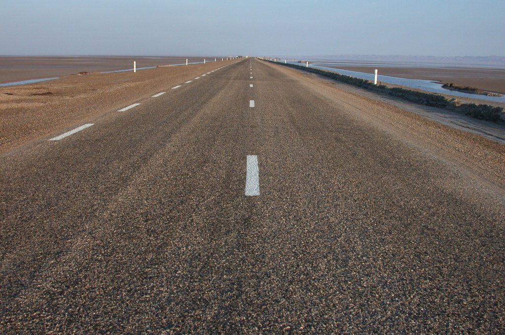
Somewhere around the twentieth kilometre of the causeway, almost everybody stops the car. No sign, no lay-by, no reason except that the road has become a thin dark line ruled across a white immensity and the horizon has dissolved into silver shimmer. People get out. They stand there. They take a photograph they know won’t work, and take it anyway.
Chott el Jerid is the largest salt lake in the Sahara: a seasonal salt pan of roughly 5,000 square kilometres in southern Tunisia, crusted dry most of the year and shallow-flooded after winter rain. The free P16 causeway crosses it in about an hour between Tozeur and Kebili. Go at sunrise or sunset.
It is the single most photographed landscape in the Tunisian Sahara and one of the few great sights in the country that costs nothing and requires no ticket, no guide and no 4×4. It is also the sight most likely to disappoint you if you turn up at the wrong hour, which is why this guide spends as much time on timing as on geology.
Chott el Jerid at a glance
| The detail | |
|---|---|
| What it is | A chott — a seasonal endorheic salt pan, the largest in the Sahara |
| Size | Roughly 5,000 sq km; sources range from 5,000 to 7,000 depending where you draw the shifting edge |
| Where | Southern Tunisia, between Tozeur/Nefta in the northwest and Kebili/Douz in the southeast |
| The crossing | The P16 causeway, around 80km Tozeur to Kebili; about an hour non-stop, 2–4 hours if you stop properly |
| Cost | Free. No toll, no gate, no ticket |
| Vehicle needed | Any ordinary hire car. The road is sealed and in good condition |
| Best months | October to April |
| Best time of day | The first and last 90 minutes of daylight |
| Water? | Usually none. A shallow sheet appears after decent winter rain, typically December to March |
| Star Wars link | The Lars Homestead exterior sits out on the salt near Nefta |
| Nearest bases | Tozeur (northwest shore) and Douz or Kebili (southeast) |
What a chott actually is
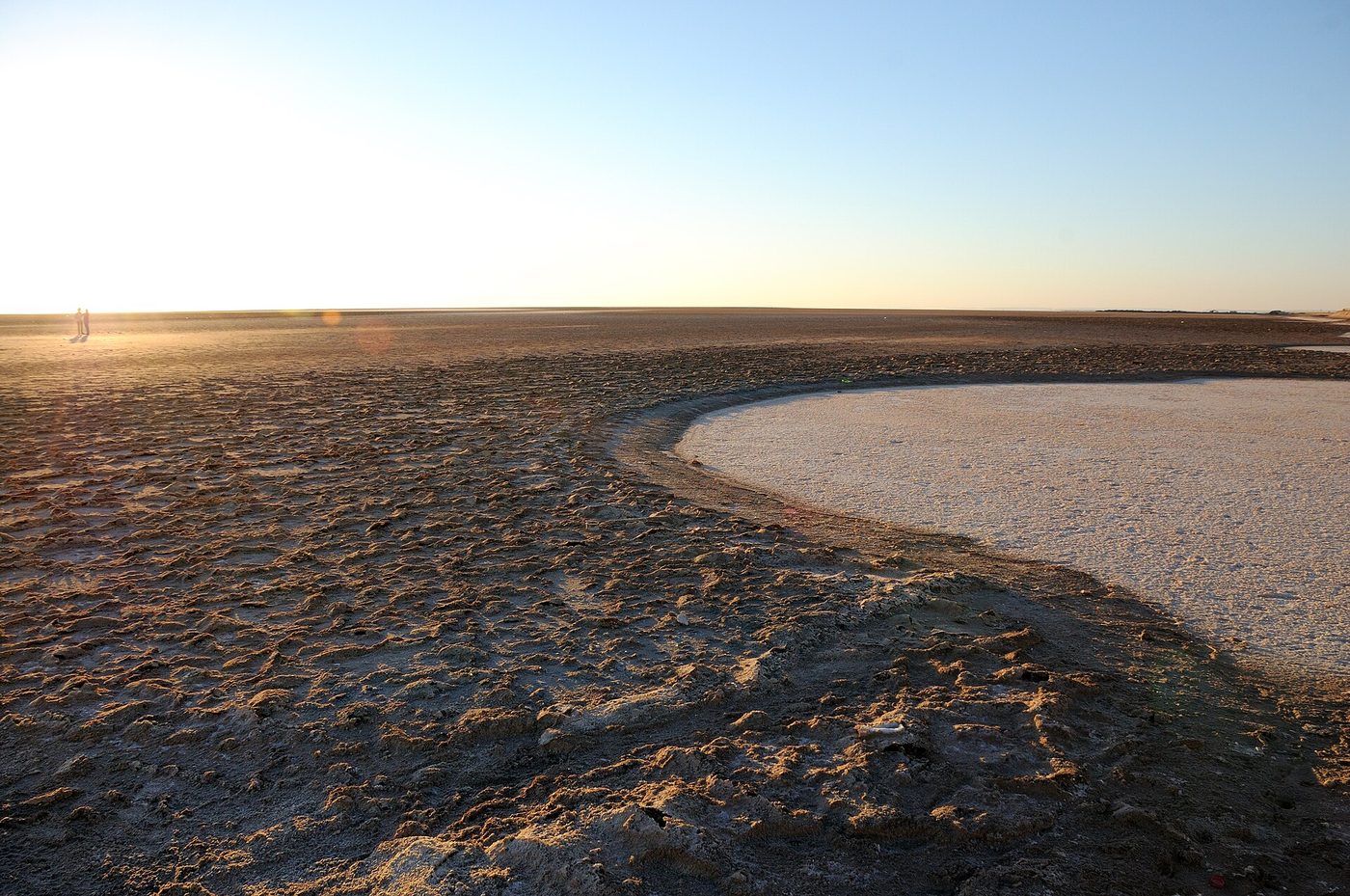
A chott is a closed salt basin with no outlet to the sea. Water arrives — from winter rain, from the aquifers under the surrounding oases — sits in a shallow sheet, and then leaves the only way it can, which is upward. What it leaves behind is salt, and then more salt, layered season on season into a crust that runs from a few centimetres to a couple of metres thick.
Chott el Jerid is the biggest of a chain of these depressions running west into Algeria. Parts of it lie below sea level, which is why the nineteenth century got excited: French engineers, most famously François Roudaire, seriously proposed cutting a canal from the Gulf of Gabes and flooding the chotts to create an inland “Saharan Sea”. The scheme was surveyed, argued over, and quietly abandoned. Herodotus, much earlier, put the mythical Lake Tritonis somewhere hereabouts. The place attracts big ideas.
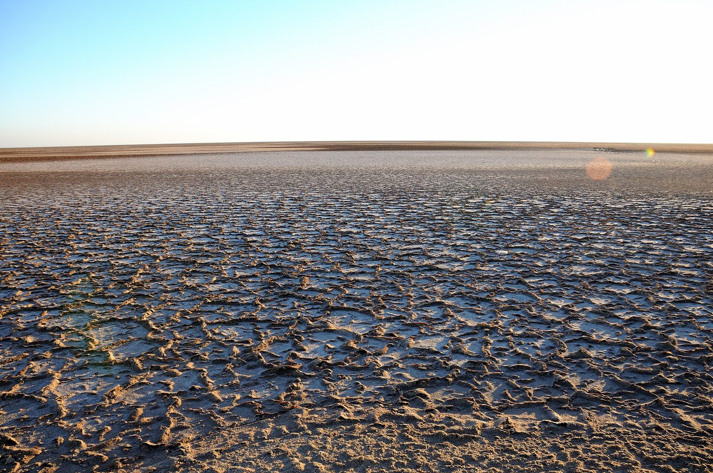
What you see on the ground is more prosaic and much stranger. The crust cracks into polygons — hexagons and pentagons of dried salt, edges curling upward — running unbroken to the horizon. In the wet patches, algae and dissolved minerals stain standing pools every shade from flamingo pink through copper to a green that looks industrial. The rest is white, and at midday it is so white that the horizon disappears entirely and the sky appears to start at your feet.
The mirages are real
This is the part that sounds like tourist-board copy and isn’t. On a warm afternoon the air immediately above the crust heats far faster than the air above it, and the resulting refraction produces textbook inferior mirages: sheets of apparent water lying across the plain, palm trees floating clear of the ground, distant lorries seeming to drive along a lake.
They are convincing enough that the chott’s caravan lore is thick with travellers who walked out toward water that wasn’t there. You’ll see them clearly from about mid-morning onward, and the effect gets stronger the hotter the day. It’s also why photographs of the chott taken at noon look so flat: your eye is reading depth and shimmer that a sensor simply records as grey haze.
The crossing: how to actually do it
The causeway is the whole experience. The P16 runs dead straight from the Tozeur side to Kebili, raised a couple of metres above the salt because the basin floods, with salt flats running to the edge of sight on both sides. There is no toll and no barrier. It is roughly 80km of it, an hour non-stop, and you should allow two to four hours because you will stop.
There are three sensible ways to fit it in.
1. As part of the Tozeur–Douz run
Most southern itineraries cross the chott anyway, moving between the oasis capital and the dune country. If that’s you, the only real planning is timing. Leave Tozeur at first light or, better, leave Douz at about four in the afternoon in winter so you are mid-causeway as the light goes gold. Do not, if you can help it, cross at one o’clock.
2. As a half-day out from Tozeur
Drive out onto the causeway, stop at the pools and the roadside stalls, turn round and come back. An hour and a half of driving, three hours all in. Tozeur is the natural base and our guide to Tozeur covers the town and its other day trips.
3. Folded into an organised 4×4 day
Every guesthouse and operator in Tozeur sells a desert day stringing together a chott crossing, the dunes and film sets to the west, and sometimes the mountain oases. Reckon on 80–150 TND per vehicle (2026 — check current), split between passengers. Coming from the coast instead, the chott appears on nearly every multi-day circuit — see our guides to the Sahara tour from Djerba and the two-day trip from Sousse and Hammamet. On a coach tour you’ll get one photo stop of about fifteen minutes, usually at a stall complex mid-causeway, and usually at the worst possible hour. That is the single biggest argument for doing the south under your own steam.
Do you need a 4×4?
No. The causeway is sealed, well maintained and perfectly comfortable in the smallest hire car on the lot. You need a 4×4 only if you’re going off the road — to the Lars Homestead out on the salt near Nefta, for instance — and going off the road is something you should only do with a driver who knows the ground. See getting around Tunisia for hire-car realities.
The rule that matters: don’t walk out on the crust
This is the one genuinely dangerous thing about the chott, and it is almost never mentioned in the brochures.
The salt crust is not uniformly solid. In many places it is a few centimetres of hard white plate sitting on top of saturated brine mud that behaves like wet cement. It looks identical to the parts that will take your weight. Vehicles get bogged out here every year, and a car sunk into brine is a very expensive recovery in a place with no phone signal and no shade.
Practical version: stay on the causeway and its formal pull-offs. Walk a few metres onto the crust where you can see other footprints and firm ground, take your photograph, and come back. Never drive off the sealed road onto the salt on your own. Never do any of it after dark.
The pink pools, and why they’re sometimes not pink
Search images of Chott el Jerid and half of them show extraordinary rose-coloured water. Turn up in mid-October and you may find a dry grey plain and wonder what you missed.
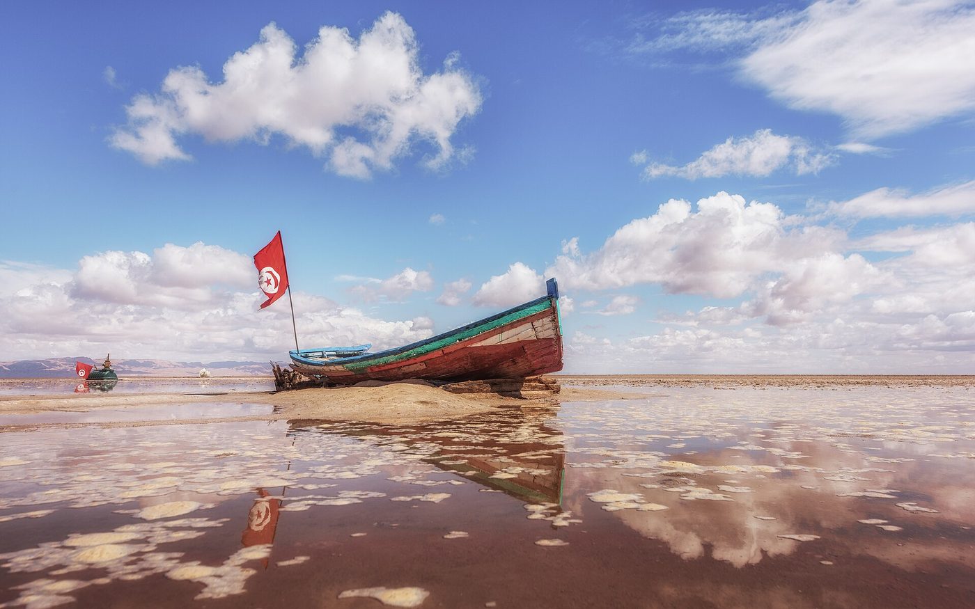
Both are true. The colour comes from halophilic algae and bacteria and from dissolved minerals concentrating as the water evaporates, so you need standing water for it — which means the weeks and months after winter rain, roughly December to March in a normal year, and not at all in a dry one. Even in the dry season some permanent pools persist near the causeway’s edges, fed by drainage from the oases, and those will usually show some colour. The most spectacular version — the entire chott as a shallow mirror reflecting the sky, which is where the “Sahara’s largest mirror” photographs come from — needs a genuinely wet winter and is a matter of luck.
If the colour is the reason you’re going, aim for January or February and accept that it’s a gamble. Our month-by-month guide to visiting Tunisia sets out the wider seasonal logic, and Tunisia in winter covers what the south is like out of season.
Honest expectations: when the chott is dull
We’ve promised you honesty, so here it is. Chott el Jerid in flat white midday light, under a cloudless sky, with no water anywhere, is a grey-white plain and a straight road. Plenty of visitors post exactly that photograph and ask what the fuss is about. They are not wrong — they were just there at the wrong time.
What transforms it:
- Low sun. The first and last ninety minutes of daylight. The crust turns rose, apricot and lilac, the polygon edges throw shadows, and the whole surface acquires texture it simply doesn’t have at noon.
- Cloud. Counter-intuitive, but a broken sky gives you something to reflect and something to frame the emptiness against.
- Water. Any at all.
- Getting out of the car. Most of the effect is the silence and the scale, and neither survives a windscreen.
Set against that: it is free, it is on your route anyway, and even the mediocre version takes about an hour. The risk-reward is excellent. Just don’t fly to Tunisia specifically for it — go for the whole southern circuit, of which this is one hour.
The roadside stalls, and the desert roses
Halfway across you’ll hit a cluster of stalls, a café or two and a small forest of painted sticks and plastic bottles that Tunisian drivers plant in the salt as markers. The vendors sell desert roses — bladed rosettes of gypsum that form naturally in salty ground — along with fossils, mineral chunks and the usual scarves.
The desert roses are real, they’re local, and they’re a couple of dinars for a small one. They are the correct souvenir from here and one of the few things in Tunisia where the asking price is often close to fair. Bigger specimens cost more and are heavy; check your baggage allowance before you fall in love with a ten-kilo one.
Expect a firm sales approach and the occasional camel available for a photograph at a negotiated price. Agree that price before the camera comes out.
Tatooine: the Star Wars connection
The chott’s second career began in 1976, when a film crew built a sunken domed dwelling on the salt near Nefta and called it the Lars Homestead — the moisture farm where Luke Skywalker watches twin suns set. The igloo-shaped entrance structure was restored by fans in 2012 and still stands out on the flats, reachable by 4×4 and quietly maintained by visitors who treat it as a shrine, because it more or less is one.
It’s one node in a whole southern constellation: Mos Espa and Ong Jemel on the neighbouring Chott el Gharsa, the Sidi Bouhlel canyon, the Matmata hotel used for the homestead interior. Our Star Wars filming locations guide maps them all and is straight about which ones the desert is winning back. Even if you couldn’t name a single character, the homestead earns its detour: a small white absurdity on an infinite white plain is a very good photograph.
Getting there and where to stay
From Tozeur (northwest shore): the causeway begins about 20km southeast of town on the road to Kebili. Tozeur has the biggest choice of hotels and dars in the region, an airport with Tunis flights, and the widest range of onward day trips.
From Douz or Kebili (southeast): Kebili sits at the far end of the causeway; Douz is another 30km south into the dune country. Staying in Douz puts you well for both the chott and the erg, and it’s the standard launch point for camel treks and for Ksar Ghilane.
By public transport: louages run to Tozeur and to Kebili, but there is no scheduled service that lets you experience the crossing properly — you’d be sitting in a shared minibus that doesn’t stop. To do the chott justice you need your own wheels or a hired driver.
What to take
- Sunglasses you’d trust on snow. The glare off a salt pan is closer to a glacier than a beach, and it comes at you from below as well as above. This is the item people most regret skimping on.
- High-factor sunscreen, including under your chin and nose. Reflected UV finds the places you didn’t cover.
- More water than seems reasonable. There is one stall complex and fifty kilometres of nothing.
- A fleece or jacket for the golden hours. The temperature falls off a cliff the moment the sun goes, and desert nights in December are properly cold.
- A scarf. For dust, for wind, and for the sun on the back of your neck.
- A full tank. Fill up in Tozeur or Kebili, not somewhere in between, because there isn’t a somewhere in between.
- Cash in small notes for the stalls. The dinar is a closed currency — you can’t buy it before you fly and can’t take it home — so change money on arrival and keep the receipts. Roughly £1 to 3.8–3.9 TND in mid-2026, but check the rate.
Safety and health, briefly
Chott el Jerid and both its shore towns sit outside every FCDO advisory zone. The restricted areas in Tunisia are the Algerian border strip, the Chaambi mountain zones in the west and the Libyan border region in the far southeast; the chott is nowhere near any of them. FCDO advice was updated 24 July 2026 and we checked it on 2 September 2026 — always re-read gov.uk’s Tunisia travel advice the week you fly, and see our date-stamped Tunisia safety guide for the full wording. One note for anyone planning to continue northwest from Tozeur to the mountain oases: that trip does enter an advisory band, and we cover it in the Chebika, Tamerza and Mides guide.
On health: your UK GHIC is not valid in Tunisia. There’s no reciprocal healthcare agreement and treatment is pay-up-front, so comprehensive travel insurance with medical cover and repatriation is essential — and if you’re adding quad bikes, camel rides or off-road 4×4 excursions, check they’re covered, because they’re common exclusions. The NHS-linked TravelHealthPro page for Tunisia has the vaccination and food-and-water advice.
The realistic hazards out here are heat, glare and dehydration, in that order, followed by the crust. Nothing else.
Chott el Jerid: your questions answered
What is Chott el Jerid?
A seasonal salt lake in southern Tunisia and the largest salt pan in the Sahara, roughly 5,000 square kilometres. It has no outlet to the sea, so the little water it receives evaporates and leaves a thick salt crust. For most of the year it is dry, cracked and blinding white.
Can you drive across Chott el Jerid?
Yes. The P16 causeway crosses it between Tozeur and Kebili — a sealed, raised, well-maintained road with no toll and no gate. Any ordinary hire car manages it comfortably. You should not drive off the causeway onto the salt itself.
How long does it take to cross Chott el Jerid?
About an hour non-stop for the roughly 80km between Tozeur and Kebili. Allow two to four hours in practice, because you’ll stop repeatedly at the pull-offs, the pools and the stalls. Coach tours typically allow a single fifteen-minute photo stop.
Why is Chott el Jerid pink?
Salt-loving algae and bacteria, plus concentrating minerals, tint the standing pools anything from flamingo pink to copper-green. You need water for the effect, so it’s strongest in the weeks after winter rain — roughly December to March — and may be absent entirely in a dry autumn.
Is Chott el Jerid worth visiting?
Yes, with one condition: go early or late in the day. At sunrise or sunset it’s one of the most extraordinary landscapes in North Africa. At flat midday, with no water and no cloud, it’s a grey plain and a long straight road. Same place, completely different experience.
When is the best time to visit Chott el Jerid?
October to April for the season, and the first or last ninety minutes of daylight for the hour. December to March gives the best chance of standing water and colour. Avoid high summer: 45°C with the salt reflecting the sun back up at you is genuinely hazardous.
Can you walk on Chott el Jerid?
A few metres from the causeway, on visibly firm ground where others have walked, yes. Not further. The crust can be a thin plate over saturated brine mud that looks exactly the same from above, and people and vehicles do get stuck. Treat it like thin ice.
Is there water in Chott el Jerid?
Usually very little. It holds a shallow sheet for a few weeks or months after winter rain and spends the rest of the year evaporating. Some permanent pools survive near the causeway edges. In a wet winter the whole basin can briefly become a vast, shallow mirror.
Was Star Wars filmed at Chott el Jerid?
Yes. The Lars Homestead exterior — Luke Skywalker’s moisture farm — was built on the salt near Nefta in 1976, reused in the prequels and restored by fans in 2012. It still stands and is reachable by 4×4. Other Tatooine sites sit on the neighbouring Chott el Gharsa.
Is Chott el Jerid the largest salt lake in the Sahara?
Yes, by area — and the largest in Tunisia and the Maghreb. Estimates run from about 5,000 to 7,000 square kilometres depending on how you define the shifting margins, which merge into neighbouring chotts and sabkhas to the west and east.
Do you need a 4×4 to see the salt lake?
No, not for the causeway crossing, which is the main event. You need one only for off-road destinations such as the Lars Homestead out on the flats, and for those you want a local driver rather than a self-drive 4×4.
Is it safe to visit Chott el Jerid?
Yes. The chott and its shore towns lie outside all FCDO advisory zones (advice updated 24 July 2026, checked 2 September 2026). The real risks are environmental — heat, glare, dehydration and the unreliable crust — not security. Cross in daylight, carry water and stay on the road.
The bottom line
The Sahara has bigger dunes elsewhere and greener oases twenty minutes up the road. What Chott el Jerid has is scale — the sort that makes you briefly and pleasantly irrelevant. An hour of white silence, a road drawn with a ruler, a horizon that has given up pretending. Time it for the low sun, get out of the car, and it will be one of the things you remember about Tunisia.
Plan the rest of the trip: base yourself in Tozeur, weigh up the day trips in our excursions guide, see where the chott ranks among the most beautiful places in Tunisia, and read the practical stuff in our Tunisia travel tips.
Written by the Tunisia Tourism Guide team — an independent UK-focused guide to travelling in Tunisia. We don’t sell tours or take hotel commissions. Prices and advisory wording were checked at publication on 2 September 2026; always confirm current details, and re-read the FCDO’s Tunisia page, before you book.
Photo credits
All images via Wikimedia Commons, used with thanks: Cracked salt crust on Chott el Jerid © Josep M. Gracia (CC BY-SA 4.0); The causeway carrying the road across Chott el Jerid between © Francesco Piraneo G. (CC BY 3.0); A stranded boat on the salt of Chott el Jerid © Atef Ouni (CC BY-SA 4.0); Sunset over the salt pan at Chott el Jerid © Josep M. Gracia (CC BY-SA 4.0).