By the Tunisia Tourism Guide team · Last updated 4 September 2026 · We don’t sell tours or take hotel commissions — this is independent advice, written to be useful.
Type tataouine tunisia into a search box and you get two completely different sets of results. Half of them are Star Wars fan pages. The other half are tour operators selling a very long minibus day out from a beach hotel. Almost none of them tell you what these buildings actually are, which ones are worth the drive, or how many hours you will genuinely spend in a vehicle to see them.
Tataouine is a small town in southern Tunisia surrounded by ksour — fortified Berber granaries built as communal food stores, not houses. The highlights are Ksar Ouled Soltane’s four-storey courtyards, the cliff village of Chenini, the near-abandoned hillside of Douiret, and Ksar Hadada. Two full days does the region justice; one very long day covers the greatest hits.
The ksour country is the eastern edge of Tunisia’s desert south, and it pairs naturally with the dunes and oases covered in our guide to the Tunisian Sahara. It also sits in a corner of the country where the UK Foreign Office draws lines on a map, so we have put that section high up rather than hiding it at the bottom — read it before you book anything.
Tataouine and the ksour at a glance
| Question | Short answer |
|---|---|
| Where is it? | Tataouine Governorate, the far south-east. Around 50km south of Medenine, 130–150km from Djerba |
| What’s the draw? | Fortified Berber granaries (ksour) and two dramatic hilltop villages, Chenini and Douiret |
| Time needed | One long day for the highlights; two days to do it properly and sleep in a ksar |
| Typical cost | Most ksour charge nothing or a token fee; guides, drivers and photography charges are the real spend (2026 — always confirm) |
| Best time of day | First two hours after sunrise, or the last two before sunset. Midday light flattens everything |
| Best time of year | October–April. Summer here regularly clears 40°C and has touched 48°C |
| Do you need a 4×4? | No, for the main circuit. The tarmac reaches Ouled Soltane, Chenini, Douiret and Ksar Hadada |
| What to skip | Trying to add Matmata and Ksar Ghilane on the same day from Djerba. You’ll see car parks, not places |
Read this first: what the FCDO says about southern Tunisia
This is the part most ksour guides leave out, and it matters more here than anywhere else on the Tunisian tourist map. Tataouine Governorate contains areas the UK Foreign Office names in its travel advice, and the boundary of one of those areas runs across the region you’d be driving through.
Here is the southern Tunisia section, quoted exactly. FCDO advice, last updated 24 July 2026 and still current when we checked on 4 September 2026 — always check gov.uk/foreign-travel-advice/tunisia before you book.
FCDO advises against all travel to:
- the militarised zone south of the towns of El Borma and Dhehiba
- within 20km of the rest of the Tunisia-Libya border area north of Dhehiba
- the town of Ben Guerdane and immediate surrounding area
In addition, FCDO advises against all but essential travel to within 75km of the Tunisia-Libya border, including Remada and El Borma but excluding Zarzis, the C118 road and all areas in Medenine Governorate north of the road.
What that means in practice
Three things follow, and we’ll take them in order of how much good news they contain.
First, the reassuring bit, and it is genuinely reassuring: Zarzis, the C118 road and everything in Medenine Governorate north of that road are carved out by name. If you’re starting from a hotel on Djerba and driving south through Zarzis and Medenine, you do not begin your day inside a restricted area. The FCDO has explicitly said so.
Second, the places named in the “all travel” bullets — Remada, Dhehiba, El Borma and Ben Guerdane — are not destinations, and you will not find them anywhere else in this guide as stops, detours or “while you’re down there” suggestions. We name them here once, so you can recognise them on a road sign, and that’s the last of it.
Third, the awkward bit. That 75km line has to fall somewhere, and it falls across Tataouine Governorate. Out of curiosity we measured the straight-line distances from the popular sites to the frontier on a map. Our rough figures put Chenini, Douiret, Ksar Hadada and Ghomrassen at something like 85–90km from the border, comfortably outside. Tataouine town itself comes out at around 75km — which is to say, near enough to the line that a few kilometres of measuring error decides it. And Ksar Ouled Soltane, the most photographed ksar of the lot, came out at roughly 60km. Inside.
We are not going to pretend our rough map-work is the FCDO’s boundary, and neither should you. The Foreign Office publishes its own map on the Tunisia advice page. Look at it, zoom in on your actual route, and make your own decision — particularly about Ksar Ouled Soltane, which is the one popular site where the answer is not obviously “outside”.
The practical consequence is money, not soldiers. The FCDO’s own wording is blunt: “Your travel insurance could be invalidated if you travel against advice from the Foreign, Commonwealth & Development Office.” An “all but essential travel” area is not a fence; it’s a condition of your cover. And because your UK GHIC is not valid in Tunisia — serious treatment means a private clinic that wants payment up front — having no cover here is a real financial exposure, not a technicality. Our honest guide to safety in Tunisia and our broader Tunisia travel advice both go into this in more detail.
What you’ll actually experience on the ground
We’d be misleading you if we stopped there, because the on-the-ground reality and the advisory wording pull in different directions.
Tunisian operators sell the ksour loop as a bog-standard coach excursion. Hotels on Djerba advertise it on a laminated board next to the diving and the crocodile farm. Ksar Ouled Soltane has a car park, an information panel, artists selling paintings from the ground-floor ghorfas and a steady trickle of European minibuses. Nobody stops you; nobody asks why you’re there.
You will meet police and National Guard checkpoints, and more of them the further south you go. They are routine, they are polite, and the drill is the same every time: slow right down, wind the window down, hand over passports or the car-hire paperwork if asked, don’t photograph the checkpoint. Foreign tourists are usually waved through in under a minute.
So: an area the FCDO words cautiously, which in practice functions as a normal tourist circuit with visible security. Both of those things are true at once. We’re not going to tell you it’s fine, because that isn’t our call to make and it isn’t our insurance policy. We’d rather hand you the exact wording, our rough measurements and the link to the official map, and let you decide like an adult.
What a ksar actually is (and why a ghorfa is not a bedroom)
Here’s the thing almost every tour guide gets slightly wrong, and it changes how you look at these buildings entirely.
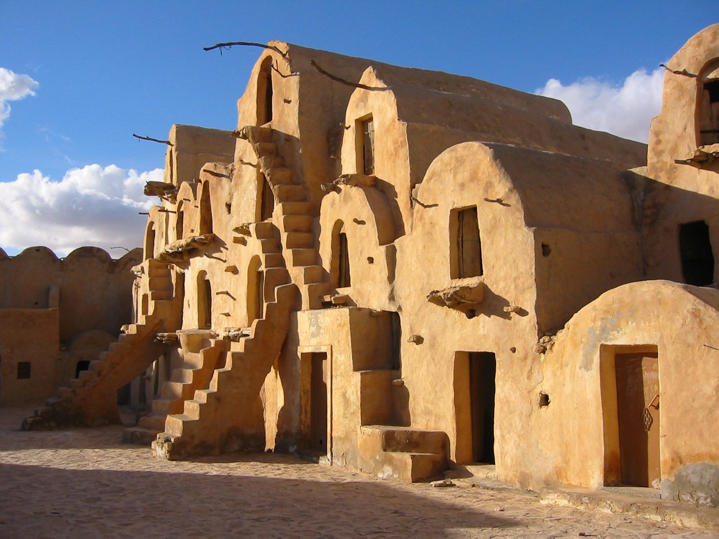
A ksar (plural ksour) in southern Tunisia is not a village and not a castle. It is a communal granary — a fortified food bank, built by semi-nomadic tribes who spent much of the year moving with their flocks and needed somewhere secure to leave the harvest. Each family or tribal fraction owned cells inside it. When raiders came, or a drought ran long, the ksar was what stood between the group and starvation.
The individual vaulted cell is a ghorfa. It’s a barrel-vaulted box, usually a few metres deep, built of mudbrick and rammed earth over a wooden or stone former, and it stored grain, olive oil, dates, cheese and whatever else mattered. Some were partitioned inside so that food and family valuables sat separately. Thick earth walls soaked up the day’s heat and released it slowly overnight; small vents let air move so grain didn’t sweat and go mouldy; building upwards kept rodents and floodwater out.
Stack ghorfas four and five high around a courtyard, run stone staircases up the outside because there’s no room for them inside, and leave the exterior wall blind — no windows, one door, ten metres tall in places — and you have the honeycomb silhouette everyone photographs. Once you know you’re looking at a granary, the design stops being picturesque and starts being obviously, ruthlessly logical.
Three kinds of ksar
Tunisia’s UNESCO tentative-list submission for the troglodyte dwellings and ksour of the south — lodged in January 2020, covering Gafsa, Gabès, Medenine and Tataouine governorates — splits them into three types, and it’s a useful lens:
- The citadel ksar — perched on a crag, defensive above all else. Chenini and Douiret are the showpieces.
- The mountain ksar — tucked into the folds of the Dahar range, often paired with cave dwellings and olive presses cut into the rock.
- The plain ksar — built lower down where the trade routes ran, and over time these drifted into being marketplaces as much as stores. Ksar Ouled Soltane is the great survivor of this type.
The same submission counts roughly 150 ksour across the region, one for each tribal fraction that owned one. You will see perhaps six. That’s fine — but it explains why you keep passing crumbling honeycombs on hillsides that nobody has bothered to signpost.
The ksour worth your time
Ksar Ouled Soltane
The one on the postcards, roughly 22–25km south-east of Tataouine, about half an hour on decent tarmac. Two linked courtyards, the western one dating to the late 17th century and the eastern extension added in the 19th, with something like 287 surviving ghorfas stacked up to four storeys. What sets it apart architecturally is the sheer number of external staircases glued to the walls, and the wooden hoisting hooks still projecting from the upper cells — the pulleys that got a sack of barley to the fourth floor.
Honest verdict: it is spectacular in early or late light and slightly disappointing at noon, when the restoration work shows. Restoration campaigns in the 1990s and more recent international support have stabilised the structure, which is unambiguously a good thing, but new plaster has gone over some of the old Berber painted symbols. Purists prefer the unrestored ksour. Everyone else takes the photograph and is very happy.
Entry has generally been free, with the costs being your driver, any guide and the informal charges that appear at busy sites (2026 — check on the day). Twenty minutes gets you round; forty-five if you climb everything and browse the little art workshops in the ground-floor cells.
Ksar Hadada
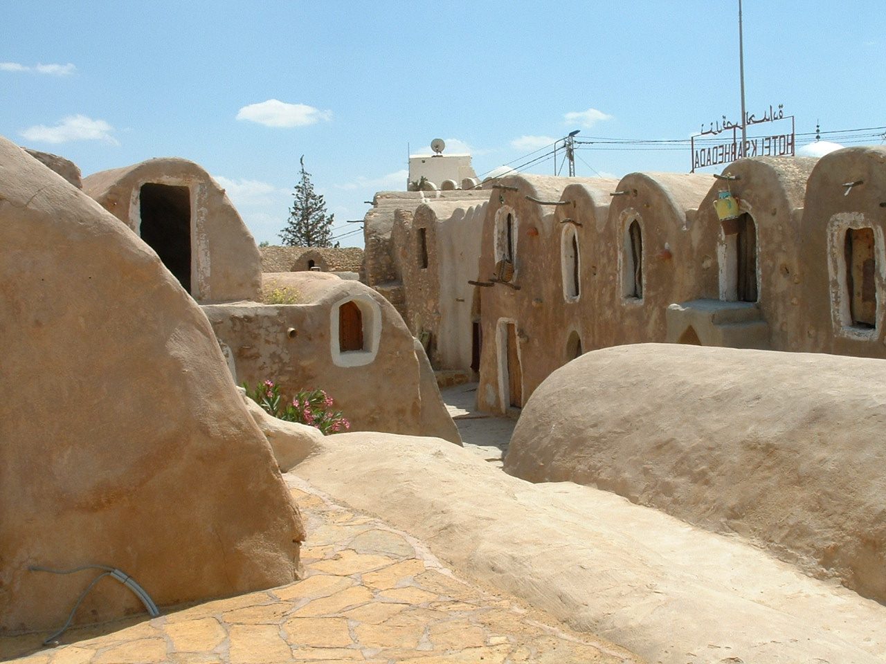
North-west of Tataouine, just beyond the town of Ghomrassen — call it 35–40km and forty minutes from Tataouine. A tighter, more maze-like ksar than Ouled Soltane, with crazily-angled passages between the ghorfas. Part of it was converted into a hotel, part was left as ruins, and its operating status has flipped more than once over the years, so don’t drive out here assuming you can get a bed or a coffee without checking first.
This is also the one with the properly documented film credit, which we’ll come to.
The quiet ones
If you have a second day, or a driver with patience, the less-visited ksour are where the region gets under your skin:
- Ksar Beni Barka — about 5km south-east of Tataouine on a commanding bluff, medieval in origin, with 500-plus ghorfas over three and four levels, eight old olive presses and a mosque. A steep 20–40 minute climb and views for miles. Our pick of the lot for atmosphere.
- Ksar Ouled Debbab — a big two-courtyard granary of around 400 ghorfas. The front half was converted into a hotel in a renovation that heritage people still wince about; the unrestored back half is the interesting part.
- Ksar el-Ferch — roughly 13km north-west of Tataouine on the Ghomrassen road, a big trapezoidal enclosure with about 280 ghorfas and an old olive press. Scruffy, unattended, and all the more evocative for it.
- Ksar Mgabla — the closest to Tataouine and walkable from town in about an hour if you’re keen. Small, neglected, genuinely atmospheric.
None of these have opening hours in any meaningful sense. They are open structures on hillsides. Wear proper shoes, watch your footing on the stairs — there are no handrails and no safety anything — and don’t climb crumbling sections.
Chenini and Douiret: the hilltop villages
These are not granaries with a car park. They are villages, and they are the emotional heart of a trip down here.
Chenini
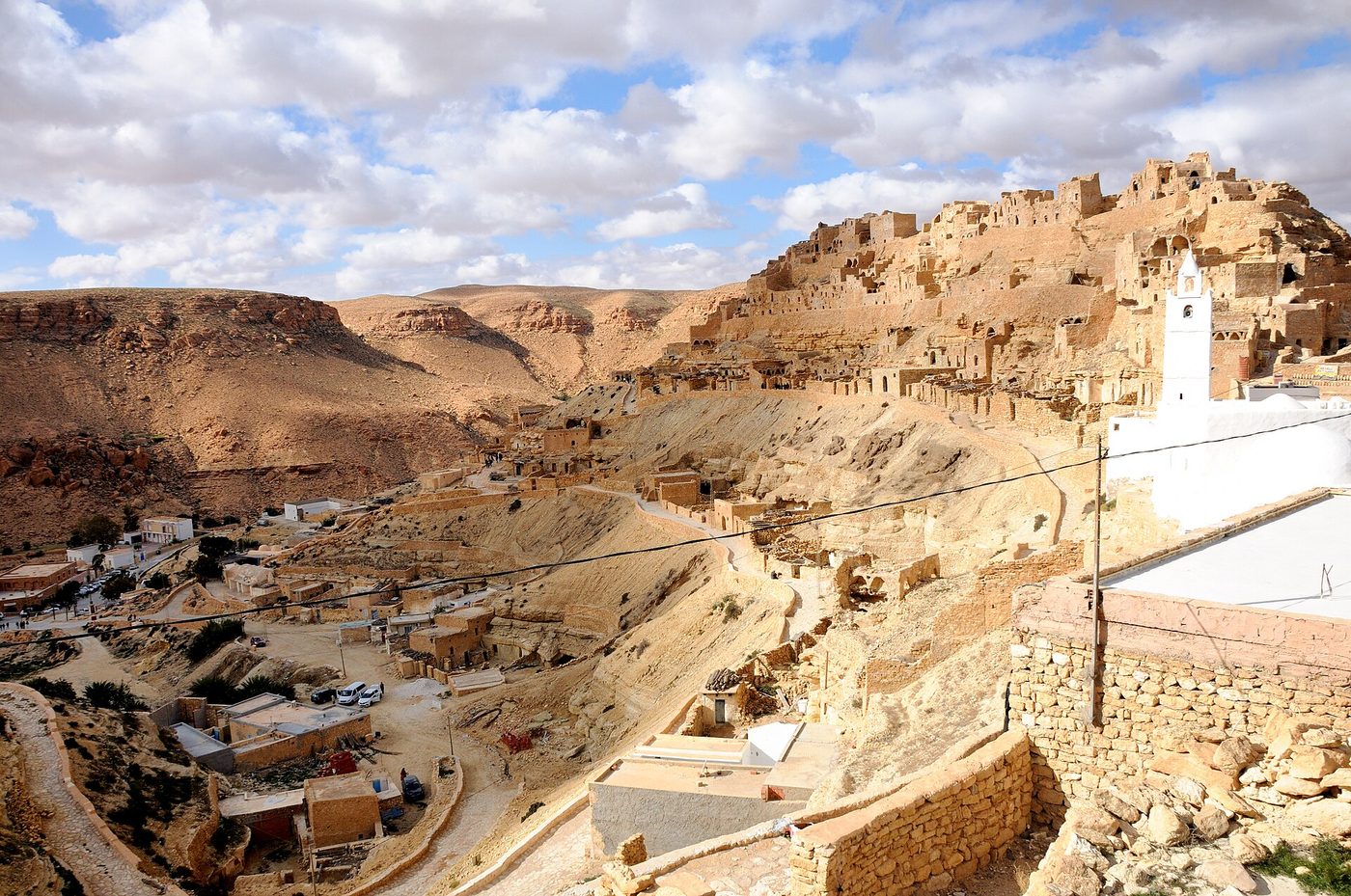
About 18–20km west of Tataouine, thirty minutes on a good road. Chenini is a Berber settlement wrapped around a knife-edge ridge, with cave dwellings cut into the rock, a ruined citadel ksar on the crest — once around 200 ghorfas on two levels — and a startling whitewashed mosque halfway up.
That mosque is the Mosque of the Seven Sleepers (Mosquée des Sept Dormants), tied to the legend of sleepers who woke after centuries; the graves beside it are unusually long, which local tradition explains by saying the sleepers kept growing while they slept. Believe what you like. Standing next to them on a hillside in the wind is the sort of moment you remember.
The walk up from the parking area to the ridge takes 20–40 minutes depending on how often you stop, and it is steep, loose and hot. There’s a modern Chenini in the valley with water and electricity; the old village still has a few hundred people living in and around the caves, though the New York Times reported in 2023 that drought and the pull of Tunis and Europe are steadily emptying it. Be aware that you are walking through somebody’s home, not a ruin. Ask before photographing people.
You will almost certainly be offered a guide at the bottom. It’s worth taking one for an hour if you want the mosque and the granary explained; agree the fee before you set off, in dinars, out loud.
Douiret
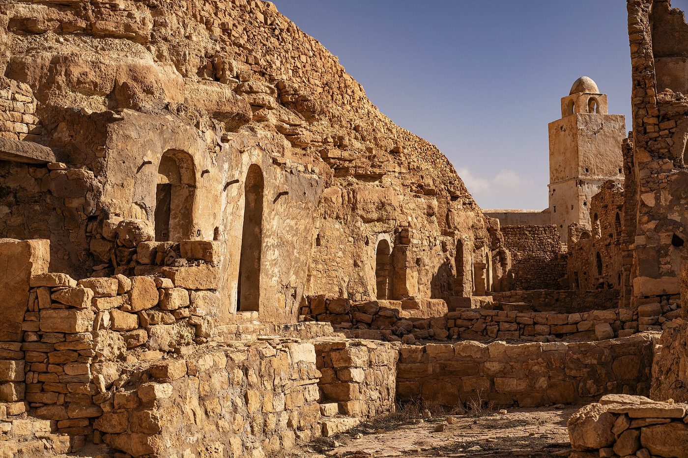
Around 22km south-west of Tataouine, and our favourite of the two. Douiret is a proper ghost village: a circular ksar-citadel on the summit with ghorfas rising three, four and even five storeys, and beneath it a three-kilometre ribbon of abandoned troglodyte houses strung along the cliff, most of them collapsing, one dazzling white mosque — the “palm tree mosque”, Jamaa ennakhla — sitting halfway along like a full stop.
Douiret has real history behind the emptiness. It was a caravan stop on the route between Gabès and Ghadames in Libya, had around 3,500 inhabitants in 1850, and was briefly France’s administrative centre for southern Tunisia in 1882 before the job moved to Tataouine. Through the 20th century its people drifted to the capital, and by the 2000s the old village was essentially abandoned for a new one at the foot of the hill.
Fewer visitors come here than to Chenini, which is exactly the point. Allow 90 minutes to walk the path properly. A couple of restored houses operate as simple guest accommodation.
Guermessa
The third hilltop village, spread over two rocky spurs with a ksar-citadel on one of them, and the least visited of the three. If you’re building a two-day trip and want somewhere you’ll have to yourself, this is it. Access is rougher and the site is largely uninterpreted, so it rewards curiosity more than it rewards a quick photo stop.
Ghomrassen and Tataouine town
Ghomrassen
A working town about 35km north-west of Tataouine, backed by cliffs riddled with cave dwellings and old granary cells. Nobody comes here for the sights, and that’s rather the appeal — it’s the last stop before Ksar Hadada and a good place to see southern Tunisia getting on with its day. Ghomrassen is also famous nationally for its fried pastries, the ftair, and for the number of its sons who went off and opened food shops in Tunis. Stop for one.
Tataouine town
Let’s be straight: Tataouine is not pretty. It’s a garrison town the French laid out in the 1890s as the base for a penal infantry battalion, and today it’s a busy provincial administrative centre of about 70,000 people. You come for the base, the beds and the market, not for architecture.
The market is the reason to time your visit. Souk days have traditionally been Monday and Thursday, when people come in from the surrounding villages and the streets fill with grain, livestock, blankets, spices and the region’s excellent dates. Confirm locally before building a day around it — market days do occasionally shift.
The Ksour Festival (Festival international des ksour sahariens) is the town’s big annual event: several days of Amazigh music, poetry, horsemanship and crafts. It has usually run in spring, most often in March, but the dates have moved between editions and it has occasionally been postponed. Check with the regional tourism office before booking flights around it.
One genuinely odd extra: the Museum of Earth Memory holds fossils and dinosaur material from the surrounding desert, including the sauropod Tataouinea hannibalis, described in 2013 and named after the town. And on 27 June 1931 a rare diogenite meteorite fell just north of Tataouine, later famous in astrobiology circles because rod-like structures in it turned out to be a desert bacterium, now called Ramlibacter tataouinensis. Not many small towns have a dinosaur and a meteorite named after them.
The Star Wars question, answered properly
This gets stated wrongly everywhere, including on tour boards, so here’s what we can actually stand behind after checking it.
The name is real. George Lucas took the name of Luke Skywalker’s home planet, Tatooine, from Tataouine. In Berber the town’s name means “water springs”; the older form was Foum Tataouine, “mouth of the springs”. Genuinely charming, and completely true.
The town itself was not a filming location. No scene was shot in Tataouine. Anyone who tells you otherwise is selling something.
Ksar Hadada is the documented one. The rear of the Mos Espa slave quarters in The Phantom Menace — the yard where young Anakin works on the podracer and Shmi has her conversation with Qui-Gon Jinn — was shot in the grounds of the Hotel Ksar Hadada, near Ghomrassen. Location researchers who visited afterwards found set-dressing still in place.
Ksar Ouled Soltane is where it gets muddy. It is routinely billed as Anakin’s home, and Wikipedia, citing Lonely Planet, says it featured in slave-quarters scenes. But specialist location guides trace the front of the slave quarters — the courtyard and the narrow street where Anakin says goodbye to his mother — to a surviving ksar in Medenine, on avenue 7 Novembre, now a bazaar. Other accounts say Ouled Soltane was scouted in 1995–96 but not used in the finished film. We can’t resolve it, so we won’t pretend to. Go for the architecture; treat the film credit as unproven.
If Star Wars is the actual reason you’re going south, the surviving Mos Espa set near Tozeur and the Sidi Driss hotel at Matmata are more reliable pilgrimages — our guide to Star Wars filming locations in Tunisia sorts the confirmed from the invented.
The driving loop: distances and a realistic day
The geography is simple once you see it. Tataouine sits in the middle. Chenini and Douiret are west and south-west, Ksar Ouled Soltane is south-east, Ghomrassen and Ksar Hadada are north-west. Everything is within about 40km of the town, but they’re on different spokes, so you backtrack a lot.
| Leg | Approx. distance | Approx. driving time |
|---|---|---|
| Tataouine → Ksar Ouled Soltane | 22–25 km | 25–30 min |
| Tataouine → Chenini | 18–20 km | 30 min |
| Chenini → Douiret (via the plain) | 25–30 km | 40 min |
| Tataouine → Ghomrassen | ~35 km | 40 min |
| Ghomrassen → Ksar Hadada | ~8 km | 10–15 min |
| Medenine → Tataouine | ~50 km | 45 min |
| Djerba → Tataouine | 130–150 km | 2–2½ hrs each way |
| Matmata → Tataouine | ~120 km | ~2 hrs |
| Douz → Tataouine | ~230 km | 3–3½ hrs |
All approximate, and all assuming daylight. Distances in southern Tunisia are honest but the roads are not motorways: expect livestock, unlit lorries, drifting sand and occasional potholes deep enough to reshape a wheel.
The one-day loop from Tataouine
If you’ve slept in or near Tataouine, this works beautifully and involves about three hours of actual driving:
- 07:30 — leave for Ksar Ouled Soltane. Low sun on the ghorfas, nobody there. 45 minutes on site.
- 09:15 — back through Tataouine, out to Chenini. Walk up to the mosque and the ridge. Two hours.
- 12:00 — lunch in Chenini or back in town. Rest through the worst of the heat.
- 14:30 — Douiret. The long path, the palm-tree mosque, the empty houses. Ninety minutes.
- 17:00 — Ksar Beni Barka or Ksar Mgabla for the last light, if legs permit.
Add a second day and you get Ghomrassen, Ksar Hadada, Guermessa and Ksar el-Ferch at a pace that lets you talk to people rather than photograph them.
Does it work as a day trip from Djerba, Douz or Matmata?
This is the question we get asked most, so here is the unvarnished answer.
From Djerba: yes, but you will spend five hours in a vehicle. Operators pick up around 07:00–07:30 and return around 17:30–18:00. Take out 4–5 hours of driving, an hour for lunch and the ferry or causeway crossing, and you have perhaps four hours on the ground split across three or four sites. That’s twenty minutes at Ouled Soltane and a hurried scramble at Chenini. It is genuinely worth doing if it’s your only option — the landscape alone justifies it — but nobody should pretend it’s a leisurely day. Our guide to day trips from Djerba puts it against the alternatives, and if the desert proper is what you’re after, a Sahara tour from Djerba uses the hours better.
Note the crossing: Djerba connects to the mainland southwards by the Roman causeway at El Kantara, which is free and always open, or by the Ajim–Jorf ferry, which is quick but can queue badly at peak times. If you’re driving yourself, take the causeway and stop fretting.
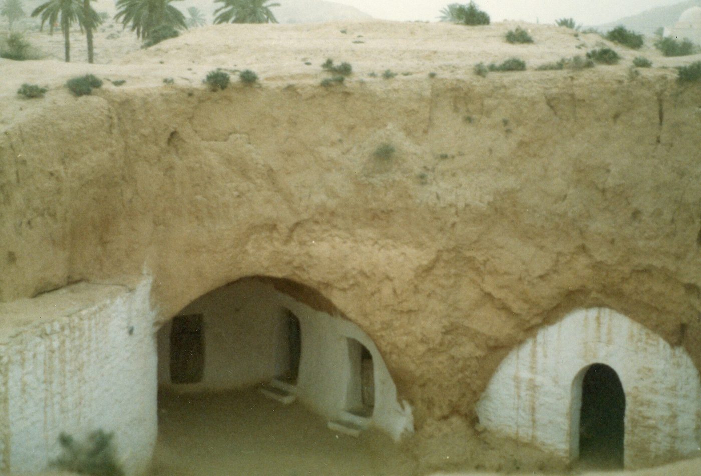
From Matmata: better. Around two hours each way, so a day trip leaves you five or six hours in the ksour. Matmata’s underground houses and the ksour are the two halves of the same Amazigh story, and doing them back to back is the single most rewarding two-day combination in southern Tunisia.
From Douz or Ksar Ghilane: no, not as a day trip. Three and a half hours each way from Douz is too much. Treat Tataouine as a stop on the way east instead, ideally with a night in the region. Ksar Ghilane and its hot spring make a natural western bookend for the same trip.
Our honest recommendation: sleep down here. One night in Tataouine or in a converted ksar transforms the whole thing from a coach trip into a proper piece of travel, and it costs less than the excursion you’d otherwise buy.
Car hire, a driver, a tour or louages?
Hire car. The most flexible option and the one we’d choose. The main circuit is sealed tarmac and a normal saloon is fine; you don’t need a 4×4 unless you’re heading off-piste towards Ksar Ghilane. You’ll want a UK licence plus a 1968-convention International Driving Permit and the insurance green card from the hire company. Do not drive between towns after dark down here — unlit vehicles, animals on the road and no lighting make it a genuinely bad idea. Our guide to a Tunisia road trip covers the paperwork properly.
Hiring a driver for the day. Very common, and often the sweet spot. A local taxi or a guesthouse-arranged driver will do a full ksour circuit for a negotiated day rate. Agree the exact list of stops, the finish time and the price before you get in, and get it repeated back to you. Prices vary hugely with season and bargaining (2026 — get a couple of quotes).
An organised tour. Best if you’re coming from Djerba and don’t want to drive. The trade-off is pace and a probable carpet-shop detour.
Louages. The shared long-distance taxis will get you to Tataouine from Medenine, Gabès or Djerba cheaply and reasonably quickly, and they’re the authentic way to travel — see getting around Tunisia. They will not get you round the ksour. There is effectively no public transport to Ouled Soltane, Chenini or Douiret. Arrive by louage, then hire a driver in town.
Where to stay
Three broad options, none of them luxurious, all of them fine:
- Tataouine town — a handful of small hotels and family-run guesthouses. Cheap, central for the loop, easy to arrange a driver from. Not atmospheric.
- A converted ksar — several ksour in the wider region have been turned into hotels, with ghorfas as bedrooms. Sleeping in a vaulted grain cell under a desert sky is the memory you’ll keep. Standards are simple, hot water can be temperamental, and opening status changes, so book directly and confirm.
- Chenini or Douiret — a few restored village houses take guests. Minimal amenities, spectacular position, best for photographers who want dawn light without a 5am drive.
We haven’t quoted rates because they move constantly and we don’t take commissions. Expect southern Tunisia to be markedly cheaper than the coastal resorts.
Practicalities nobody mentions
- Money. The dinar is a closed currency — you can’t buy it before you fly and can’t take it home. Change money on arrival and bring plenty of small notes south, because card acceptance in the ksour villages is close to nonexistent and cashpoints exist in Tataouine and Ghomrassen but not much beyond. More in our Tunisia travel tips.
- Water and shade. Two litres per person minimum, a hat, and real sun cream. Tataouine’s record high is 48.6°C. There is no shade on a ksar roof.
- Photography charges. Many Tunisian sites levy a separate camera fee, and informal “guide” charges appear at popular ksour. Ask what’s included before you hand anything over.
- Footwear. Trainers minimum, proper walking shoes ideally. The Chenini and Douiret paths are loose scree in places.
- Dress. This is conservative rural Tunisia and you’ll be walking past people’s front doors. Shoulders and knees covered, for everyone.
- Timing. October to April, no argument. See our month-by-month view on the best time to visit Tunisia.
- Insurance. Comprehensive cover with medical and repatriation, and check the FCDO zones point above before you buy.
Is it worth it? Our verdict
Yes — with two conditions. Give it more than a snatched day if you possibly can, and read the FCDO page and its map yourself before you commit.
What you get in return is the least resort-like corner of a country most Britons only see from a sunlounger: a landscape of bare ochre ridges and stone villages that were built for survival rather than for looking at, and an Amazigh culture that predates every empire that has passed through. Chenini at eight in the morning, with the mosque catching the light and nobody else on the path, is one of the finest things we’ve done anywhere in North Africa. If you’re building a wider route, our Tunisia itinerary shows how to slot the south in, and the ksour sit alongside the country’s other UNESCO-listed and tentative-list sites as evidence that Tunisia’s best material isn’t on the beach. Pair it with a night’s camel trekking in the Sahara and you have a week that no all-inclusive can touch.
Frequently asked questions
Is Tataouine worth visiting?
The town itself is functional rather than beautiful — a French-built administrative centre with a good twice-weekly market. What makes the trip worthwhile is everything within 40km of it: Ksar Ouled Soltane, Chenini, Douiret and Ksar Hadada. Treat Tataouine as your base and the ksour as the destination, and it’s one of the most rewarding corners of Tunisia.
What is a ksar and what is a ghorfa?
A ksar (plural ksour) is a fortified communal granary built by semi-nomadic Berber tribes to store grain, oil and dates safely. A ghorfa is one vaulted storage cell inside it. They were food stores, not homes, which is why they have blind outer walls, one door and staircases running up the outside. Understanding that changes how the buildings read.
Can you visit Tataouine as a day trip from Djerba?
Yes, and thousands do — but it’s a long day. Reckon on 2 to 2½ hours each way, a pick-up around 07:00 and a return near 18:00, leaving roughly four hours split between three or four sites. It works if it’s your only option. If you can spare a night in the region instead, the trip improves enormously.
Is Tataouine safe to visit?
The ksour circuit functions as a normal tourist route with visible, routine police checkpoints. But Tataouine Governorate sits near the FCDO’s “within 75km of the Tunisia-Libya border” advisory boundary, and Ksar Ouled Soltane appears to fall inside it on our rough map measurement. Read the FCDO’s own map before booking, and check your insurance covers your route.
Was Star Wars filmed in Tataouine?
Not in the town. Lucas borrowed the name Tataouine for the planet Tatooine, but no scene was shot there. Ksar Hadada, near Ghomrassen, is the documented location — the rear of the Mos Espa slave quarters. Ksar Ouled Soltane’s credit is disputed: some sources say it featured, others that it was scouted but not used.
How much does it cost to visit Ksar Ouled Soltane?
Entry has generally been free, with your real costs being transport, any guide you take on, and the camera fees or informal charges that appear at popular Tunisian sites. Prices and practices change, so confirm on the day. Budget your money for the driver rather than the ticket — that’s where the day’s cost actually sits.
Do you need a 4×4 for the ksour?
No. Sealed roads reach Ksar Ouled Soltane, Chenini, Douiret, Ghomrassen and Ksar Hadada, and an ordinary hire car handles all of them. You’d want a 4×4 only for the rougher desert tracks west towards Ksar Ghilane, or for the more obscure ksour reached by unsurfaced pistes. Avoid driving between towns after dark regardless.
How many days do you need in the Tataouine region?
One full day covers Ksar Ouled Soltane, Chenini and Douiret at a brisk pace. Two days adds Ghomrassen, Ksar Hadada, Guermessa and a couple of the unvisited ksour, plus time to actually talk to people. Two is our recommendation; one is workable; a day trip from Djerba is the compressed version of one.
Can you visit Chenini and Douiret without a guide?
Yes. Both are open hillsides with paths, and you can walk them freely. Local guides will offer their services at the parking areas, and taking one for an hour at Chenini is genuinely worth it for the Mosque of the Seven Sleepers and the granary. Agree the fee out loud, in dinars, before you set off.
What is the Ksour Festival and when is it?
The Festival international des ksour sahariens is Tataouine’s main annual event: several days of Amazigh music, poetry, horsemanship and crafts. It has usually run in spring, most often March, but dates have shifted between editions and it has been postponed before. Confirm with the regional tourism office before you book flights around it.
Can you get to Tataouine by public transport?
Yes, to the town. Long-distance buses run from Tunis in around seven to eight hours, and shared louages connect Tataouine with Medenine, Gabès and Djerba cheaply. Getting round the ksour is the problem: there’s effectively no public transport to Ouled Soltane, Chenini or Douiret. Arrive by louage, then hire a driver for the day in town.
When is the best time of year to go?
October to April. Daytime highs sit in the comfortable twenties for much of that window, and the light is better. Summer here is brutal — July and August averages push towards 38°C with records near 48°C — and walking up to Chenini in that heat is miserable at best. Winter nights get genuinely cold, so pack a fleece.
Written by the Tunisia Tourism Guide team — an independent UK-focused guide to travelling in Tunisia. We don’t sell tours or take hotel commissions. Prices and advice were checked at publication; always confirm current details before you book.
Photo credits
All images via Wikimedia Commons, used with thanks: The four-storey vaulted ghorfas and external staircases of Ksar Ouled © Ian Sewell (CC BY 2.5); Panoramic view of the Berber hilltop village of Chenini near © Josep M. Gracia (CC BY-SA 4.0); Domed roofs and vaulted ghorfa cells inside Ksar Hadada near © Asram (CC BY-SA 3.0); The abandoned Berber hillside village of Douiret in the Tataouine © Skander zarrad (CC BY-SA 4.0).