By the Tunisia Tourism Guide team · Last updated 1 September 2026 · We don’t sell tours or take hotel commissions — this is independent advice, written to be useful.
There’s a stretch of Tunisian coast that barely exists in English. Drive north out of Tunis and the hotels stop, the coaches stop, the signage stops, and you’re on a green, wind-blown shore of cork forest and pale sand that looks nothing like brochure Tunisia. Almost no British visitor sees it.
The northern Tunisia beaches run roughly from Ghar el Melh in the east to Cap Negro in the far west, taking in Rafraf, Sounine, Sidi Ali El Mekki, Cap Serrat and Sidi Mechrig. They are the country’s emptiest and most dramatic — and its least developed. Expect no sunbeds, patchy facilities, rough access roads and a real need for a car.
This is the wild end of the Tunisia beaches we cover in full elsewhere. If you’re after loungers, watersports and a bar at the sand’s edge, go south to the resorts and be happy. If you want a beach with nobody on it and a picnic in the boot, keep reading — but go in with your eyes open, because this coast asks something of you.
The beaches at a glance
Drive times below are rough and depend heavily on the state of the last few kilometres, which is often the slow bit. Treat them as planning estimates, not promises.
| Beach | From Tunis | From Bizerte | Access | Facilities | Best for |
|---|---|---|---|---|---|
| Ghar el Melh | ~1 hr | ~45 min | Easy — sealed road to the village | Cafés, small shops, fish restaurants | Lagoon, Ottoman forts, the ramli gardens |
| Sidi Ali El Mekki | ~1 hr 15 | ~1 hr | Sand track along the spit; slow, soft in places | Seasonal reed-hut cafés only | The single most spectacular setting on the coast |
| Rafraf | ~1 hr 15 | ~45 min | Easy — road runs to the beach | Free car park, seasonal lifeguards, parasol hire, cafés | The most accessible wild-ish beach; families |
| Sounine | ~1 hr 20 | ~50 min | Easy, then a short walk | Very little; a café or two in season | Escaping the Rafraf weekend crowd |
| Cap Zbib | ~1 hr 20 | ~40 min | Moderate; rough final stretch | None to speak of | Clear water and rock pools |
| Cap Serrat | ~2 hrs | ~1 hr 30 | 10km lane off the Sejnane road through forest | Seasonal café-camp; nothing else | Total emptiness; camping |
| Sidi Mechrig | ~2 hrs | ~2 hrs | Long mountain road, then a descent to the village | Eco-tourism centre with parking; minimal otherwise | Roman ruins on the sand; snorkelling |
| Cap Negro | ~2 hrs 30 | ~2 hrs 15 | Difficult; national park, tracks | None | Serious explorers only |
What this coast is actually like
The first thing that surprises people is the colour. Northern Tunisia is green. The hills behind the shore are cork oak and pine, not palm and scrub, and between October and March it rains here properly — this coast catches Atlantic-flavoured weather that the south never sees. In spring the verges are wildflowers. It looks more like Corsica than the Sahara.
The second thing is the sea. It is a different animal from the flat, warm water at Djerba or Hammamet. There’s swell, there’s wind, there are days when the surf is genuinely lively, and the water runs cooler than on the east coast — sometimes several degrees cooler in the shoulder months. Our Tunisia sea temperature guide has the numbers; the practical summary is that swimming here is comfortable from about late June to early October and bracing either side.
The third thing is the absence. No hotels on the sand. No loungers. No jet skis, no parasailing, no man with a laminated menu. In most places, no lifeguard, no toilets, no bins and no shade. On a Tuesday in June at Cap Serrat you may share several kilometres of beach with a herd of cows and nobody else. In mid-August, on the same beach, you’ll find Tunisian families three deep with tents and speakers. Both are true, and which one you get depends entirely on your timing.
The beaches, east to west
Ghar el Melh and the lagoon
Start here, because it’s the easiest introduction and the most interesting thing on the coast that isn’t strictly a beach. Ghar el Melh — “cave of salt” — was a seventeenth-century corsair port, and three Ottoman forts still stand around a wide, shallow lagoon, one of them slowly silting into the water and used as a fishing shelter.
The lagoon is a Ramsar wetland (listed in 2007) and the sandbars separating it from the sea carry one of the strangest bits of agriculture in the Mediterranean: the ramli gardens, “grown on sand”. Andalusian settlers arriving in the 1600s worked out that a lens of fresh water floats on the salt water beneath the dunes, and planted straight into it, using reed screens against the salt spray and hedges to hold the sand. They still grow potatoes, onions and beans this way — most plots run to under five hectares — and the FAO recognised the system as a Globally Important Agricultural Heritage System in 2020. You can see the plots from the road, and it’s genuinely worth slowing down for.
The village itself has cafés and a couple of fish restaurants. The beach at Ghar el Melh proper is functional rather than beautiful. The reason you come is what’s at the end of the sandbar.
Sidi Ali El Mekki
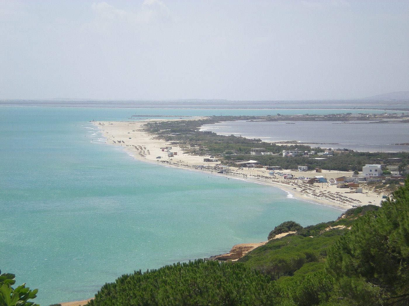
This is the one. A bare spit of soft sand running out between the still lagoon on one side and the open Mediterranean on the other, ending at a headland with a marabout’s tomb on it. There is nothing on it except a scatter of seasonal cafés made of reed and driftwood, small boats pulled up on the sand, and — in July and August — a lot of Tunisians who consider this one of the great beaches of their country and are entirely correct.
Getting there is half the experience and the half that goes wrong. The track out along the spit is sand, and it gets soft. Plenty of ordinary hire cars make it in dry conditions; plenty of others get stuck and need pushing. If you’re at all unsure, park where the tarmac ends and walk, or take one of the small boats that run across the lagoon from Ghar el Melh in season. Do not attempt it after heavy rain.
Facilities amount to a reed hut selling grilled fish and cold drinks in high season and absolutely nothing out of it. Bring water. There is no shade beyond what you make.
Rafraf
Rafraf beach is the most famous name on this coast and the easiest to reach — the road runs right down to it, there’s a free car park, and in season there are lifeguards, cafés and parasols for hire at around 20 TND a day (2026 — check current). For a lot of visitors that combination makes it the sensible pick: wild scenery, but with a toilet and somewhere to buy a bottle of water.
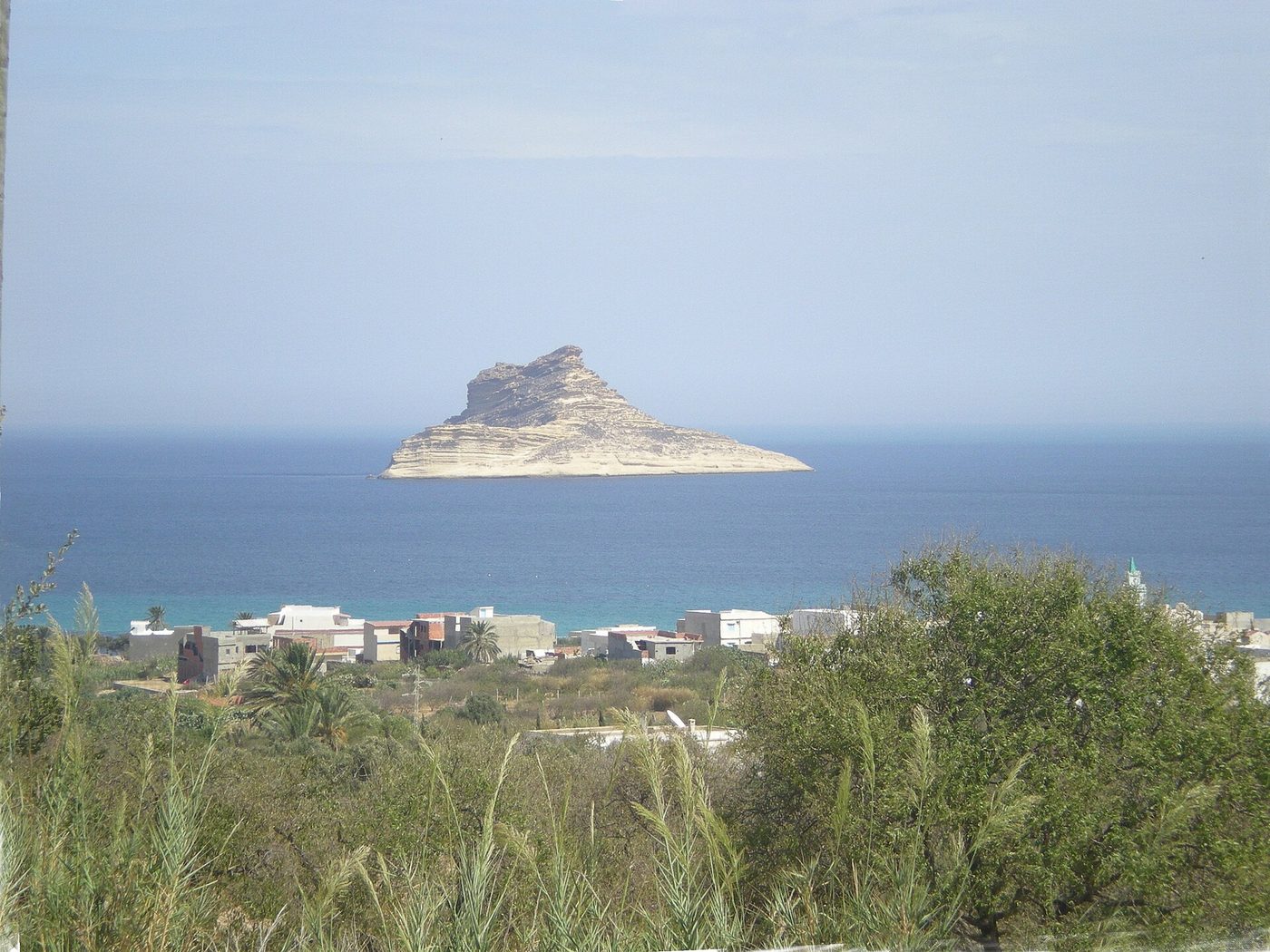
The setting is superb. A long arc of pale sand backed by hills of vines and olives, with the jagged offshore rock of Pilau island sitting out in water that shifts from turquoise in the shallows to something close to ink further out. Walk fifteen minutes east or west from the town section and the crowd thins to almost nothing, the forest comes down to the sand, and you’re on the wild beach the pictures promise.
Be honest with yourself about timing, though. Rafraf is a domestic summer institution. In August, and on any summer weekend, the central stretch is packed, the car park overflows onto the verges, and the litter afterwards is a real problem. Come on a weekday, come in June or September, and it’s a different beach entirely.
Sounine
Just west of Rafraf, and the obvious escape when Rafraf is heaving. Sounine is a small village with a beach below it that gets a fraction of the traffic — partly because the access is a bit fiddlier and partly because nobody outside the region has heard of it. Facilities are close to nil: expect a café in high season and nothing dependable otherwise. The reward is a quieter version of the same coastline. If you’re already at Rafraf and it’s rammed, drive ten minutes and try here.
Cap Zbib
Between Rafraf and Bizerte, Cap Zbib has picked up the local nickname of the Tunisian Seychelles — an overstatement, but you can see the logic when the sun is out and the water over the rocks goes that particular pale green. It’s a rockier, coves-and-pools sort of place rather than a long-strand beach, which makes it good for snorkelling and less good for a day with small children. The final approach is rough. There are no facilities. Bring everything.
Cap Serrat
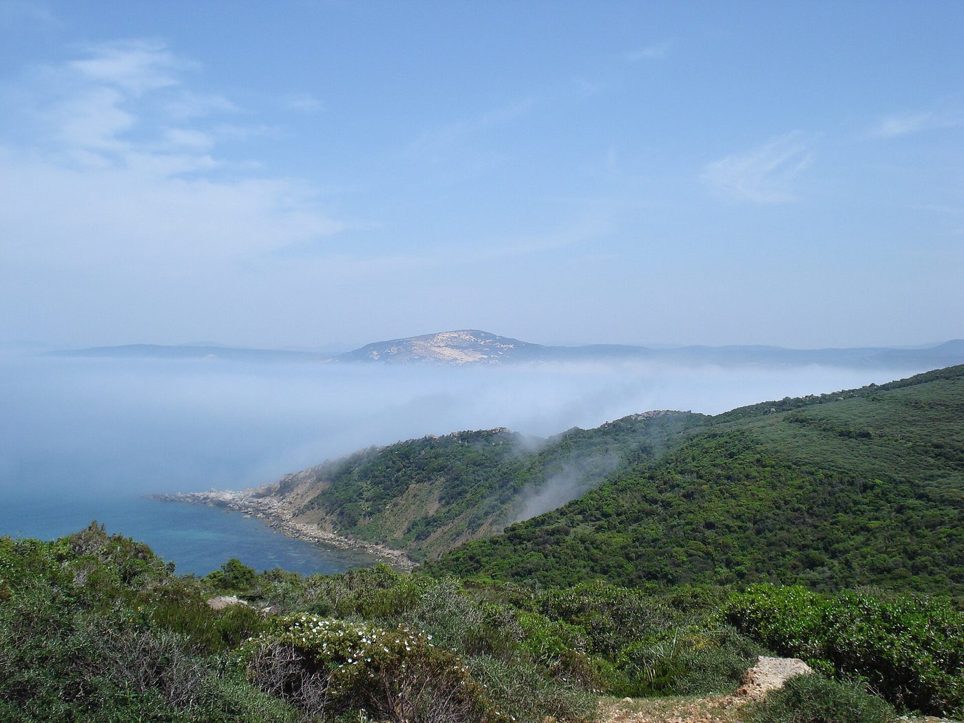
The furthest most people get, and the one that lodges in the memory. From the Sejnane road a winding lane drops about ten kilometres through cork oak forest before spilling out at a horseshoe of pale sand between forested headlands, a lighthouse on the point above. Long strands run away in both directions. The whole area is classified as a sensitive natural zone, which is why it has stayed as it is.
Out of season there is effectively nothing here — a seasonal café-camp, some summer tents, forest, dunes and sea. In August it becomes a low-key camping destination for Tunisians in the know. Either way, you need to arrive self-sufficient: water, food, sun cover, fuel in the tank. The nearest proper shops are a long way back up that lane.
The drive is the other thing to plan for. Two hours from Tunis is realistic, and the last section is slow. Don’t attempt it as a there-and-back afternoon; make it the point of the day.
Sidi Mechrig
Further west again, roughly halfway between Cap Serrat and Cap Negro and inland of the coast road between Nefza and Sejnane, Sidi Mechrig has something none of the others do: Roman ruins standing on the beach itself. The remains of a thermal bath complex sit in the sand at the water’s edge, arches and all, and you can swim beside them. It is a bizarre and rather wonderful sight, and there is no ticket office, no barrier and usually no one else.
Access is a commitment — allow about two hours from either Tunis or Bizerte, with a long stretch over the hills before the road drops down to the village and its small fishing harbour. There’s a local eco-tourism outfit at the village that runs snorkelling, paddleboarding and walking, and provides parking; beyond that, facilities are minimal. This is the one we’d pick for a proper day out with a snorkel and a packed lunch.
Cap Negro
The far western end, inside the Jebel Chitana–Cap Négro national park. Beautiful, forested, mostly inaccessible without local knowledge and the right vehicle, and not somewhere we’d send a first-time visitor. Mentioned for completeness. If you’ve got this far west, you’re close to Tabarka, which has the coral coast, actual hotels, and the best diving in Tunisia — a far more practical base for exploring this end of the shore.
Do you need a car? Almost certainly yes
We’ll be blunt about this because it determines whether the trip works at all. No bus or louage serves these beaches properly. Louages will get you to the towns — Ghar el Melh, Rafraf, Sejnane — but the beaches themselves, and particularly Sidi Ali El Mekki, Cap Serrat and Sidi Mechrig, sit at the end of roads that public transport does not run down.
Your realistic options:
- Hire car. The right answer. This is the one region of Tunisia where car hire genuinely transforms what you can see. A standard hatchback handles everything except the soft sand at Sidi Ali El Mekki and the tracks around Cap Negro. Read the excess and deposit terms carefully before you book.
- Private driver for the day. Agree a flat rate in advance covering waiting time. Split three or four ways it’s reasonable value, and it removes the parking-on-sand anxiety entirely.
- Louage plus taxi. Workable for Rafraf and Ghar el Melh, painful for anything further west. You’ll spend more of the day arranging transport than swimming.
- Organised excursion. Rare. A few operators run day trips to Rafraf and Ghar el Melh in summer; nobody much goes further.
Our full guide to getting around Tunisia explains how louages, trains and taxis actually work, including the meter etiquette that saves you being overcharged. For this coast specifically, download offline maps before you leave — mobile signal is unreliable in the forest and several of the turnings are unsigned.
What to bring
Treat a day on this coast like a hike rather than a beach day, and you’ll have a much better time.
- Water — more than you think. There is no reliable place to buy it at most of these beaches.
- A picnic. Seasonal cafés close outside July and August, and even in season they’re limited.
- Shade. A beach umbrella or a shelter of some kind. Natural shade is scarce and the northern sun is not gentle in July.
- Cash in small notes. Nowhere here takes cards. Nowhere.
- A full tank. Petrol stations thin out west of Bizerte.
- Bin bags. Take your rubbish home. We’ll come back to why.
- Something with sleeves. These are family beaches used by local people. Swimwear on the sand is fine; walking through a village in it is not.
When to go
June and September are the sweet spot and it isn’t close. You get warm-enough water, long days, open seasonal cafés and — crucially — none of the August crush. Weekdays beat weekends by a wide margin all summer.
July and August bring the best sea temperatures and the domestic holiday season at full volume. Tunisian families take these beaches seriously, and Rafraf and Sidi Ali El Mekki in particular can be extremely busy, with traffic to match on the approach roads. It’s a good-natured atmosphere if you’re in the mood for it, and the exact opposite of the empty-coast fantasy if you’re not.
Spring is lovely for scenery and wildflowers but the sea is cold. Autumn past mid-October gets windy and wet. Winter has its own moody appeal for a coastal drive, but you won’t be swimming. Our best time to visit Tunisia guide covers the country month by month, and we’ve written up June in Tunisia and September in Tunisia in detail if you’re picking dates.
The honest downsides
We rate this coast highly. We would also rather you knew what you were driving towards.
- No facilities, and we mean none. At several of these beaches there is no toilet, no shop, no lifeguard and no shade. That’s a serious consideration with young children or anyone with mobility needs.
- Litter. This is the one that shocks people. After busy summer weekends some stretches — Rafraf especially — are strewn with plastic. Clean-up efforts happen, but they lag behind the crowds. Weekday mornings early in the season are markedly better.
- Access roads. Rough surfaces, unsigned junctions and, at Sidi Ali El Mekki, soft sand that traps cars weekly. Build in more driving time than the map suggests.
- August crowds. Not the wild empty coast at all for about six weeks of the year.
- Currents and swell. The north coast has proper waves and, in places, rip currents, with almost no lifeguard cover. Swim within your ability and never alone.
- Weather variability. A grey, blowy day here is very grey and very blowy. There’s no indoor plan B.
None of that is a reason to skip it. It’s a reason to bring water, go on a weekday, and not treat a national park beach like a resort.
Where to stay
There is no hotel strip out here, which is the point, so most people base themselves elsewhere and drive out.
- Bizerte. The obvious base for the eastern half. Small guesthouses in the old town, a few seafront hotels on the Corniche, and everything from Ghar el Melh to Cap Serrat within reach. It’s also a genuinely enjoyable city in its own right.
- Tunis. Fine for Ghar el Melh and Rafraf as day trips, too far for anything west of Bizerte. See our roundup of day trips from Tunis for how it slots in.
- Tabarka. The base for the western end and the coral coast.
- Guesthouses and rentals in Rafraf and Ghar el Melh. A growing number of small apartments and villas, mostly aimed at the domestic market and mostly booked out in August. Worth it if you want early mornings on an empty beach.
Food on the coast
Fish, mainly, and very good. Ghar el Melh and Sidi Mechrig are both working fishing harbours, and the small restaurants around them grill whatever came in that morning, priced by weight. Ask the price per kilo before it goes on the grill — that’s where visitors get caught out, not through dishonesty so much as a failure to check.
Away from those two villages, plan to self-cater. Buy bread, tuna, harissa, tomatoes and fruit in Bizerte or Rafraf before you head west and make a proper picnic of it. It’s cheap, it’s the local way of doing a beach day, and it’s a great deal more reliable than hoping a seasonal café is open.
Two days that work
The easy day: lagoon and Rafraf
From Tunis or Bizerte, drive to Ghar el Melh for mid-morning. Look at the forts and the ramli gardens along the sandbar, then continue out to Sidi Ali El Mekki — walking the last stretch if the sand looks soft — and swim. Late lunch of grilled fish back in the village. Rafraf in the afternoon for the wider beach and the view towards Pilau, with a walk east away from the crowd. Home by early evening. Suitable for an ordinary hire car and a normal appetite for adventure.
The committed day: the wild west
Start early from Bizerte. Head for Cap Serrat via the Sejnane road, allowing a good hour and a half and a slow final ten kilometres through the forest. Spend the morning there — it’s the emptiest beach on the coast and the one that justifies the drive. Picnic. In the afternoon, either continue west to Sidi Mechrig for the Roman baths on the sand and a snorkel, or turn back and take the coastal detours you skipped on the way out. Full tank, full water bottles, and don’t plan anything for that evening.
Is it safe?
In ordinary terms, yes. This is a rural, family-oriented region with very little crime aimed at visitors and none of the vendor pressure of the resort medinas. Take the usual sensible precautions — don’t leave valuables in a visible car, don’t leave bags unattended on an empty beach.
The real risks here are natural rather than human: swell and currents on an unpatrolled coast, sun exposure with no shade, and getting a car stuck a long way from help. Swim conservatively, tell someone where you’re going, and don’t set off down an unfamiliar track in the late afternoon.
On official advice: the UK Foreign, Commonwealth and Development Office advises against all travel to certain areas of Tunisia, including the Chaambi Mountains National Park area and remote sections of the Algerian and Libyan border regions, and advises against all but essential travel to several interior governorates. Checked on 1 September 2026, that advice was last updated on 24 July 2026. None of those zones is on this coast — the beaches in this guide all lie in the far north, well away from them. Read the live wording at gov.uk/foreign-travel-advice/tunisia before you travel, and see our date-stamped is Tunisia safe guide for the full picture.
For health, check the NHS-backed TravelHealthPro Tunisia country page before you fly. Note that the UK GHIC is not valid in Tunisia, so proper travel insurance with medical cover and repatriation is essential — particularly relevant on a coast where the nearest hospital can be an hour or more away.
A note on money
Bring cash and bring it in small notes. The Tunisian dinar is a closed currency: you can’t buy it in the UK before you fly and you can’t take it out again, so you change money on arrival and convert the remainder back before you leave. Keep your receipts. Rates have been running around 3.8–3.9 dinars to the pound in mid-2026, but check before you travel. Out on this coast there are no card machines and few ATMs west of Bizerte — draw what you need before you set off. More on the practicalities in our Tunisia travel tips.
Northern Tunisia beaches: your questions answered
Which is the best beach in northern Tunisia?
For sheer setting, Sidi Ali El Mekki — a sand spit between lagoon and open sea with almost nothing built on it. For emptiness, Cap Serrat. For the best balance of scenery and facilities, Rafraf, which has a car park, seasonal lifeguards and cafés while still feeling wild once you walk away from the centre.
Can you get to these beaches without a car?
Only just, and only the easternmost. Louages reach Rafraf and Ghar el Melh, and a taxi can fill the gap. Cap Serrat, Sidi Mechrig and Cap Negro have no practical public transport at all. If you want to see this coast properly, hire a car or arrange a driver for the day.
How far is Rafraf from Tunis?
Roughly 65–70km, which is about an hour and a quarter of driving depending on traffic out of the capital. From Bizerte it’s nearer 45 minutes. Both are comfortably day-trip range, and the road is sealed the whole way to the beach.
Are the northern beaches good for families?
Rafraf and Ghar el Melh are, with reservations — there are toilets, cafés and seasonal lifeguards at Rafraf. The wilder beaches are harder work with small children: no facilities, no shade, rough access and unpatrolled water with real swell. Our Tunisia with kids guide sets out the gentler alternatives.
How cold is the sea on Tunisia’s north coast?
Cooler than the east and south — this coast is more exposed and less sheltered. Comfortable swimming is broadly late June to early October, peaking in August, with spring and late autumn distinctly bracing. Check our sea temperature guide for month-by-month figures.
Is Cap Serrat worth the drive?
If empty beaches are what you’re after, yes — it’s about two hours from Tunis and the final ten kilometres through cork forest are slow, but you emerge at a horseshoe of sand between wooded headlands with next to nobody on it. Go self-sufficient: water, food, fuel and shade, because there’s nothing there.
Are there hotels on these beaches?
No. There is no resort development anywhere on this stretch, which is precisely why it looks the way it does. Base yourself in Bizerte for the eastern half or Tabarka for the west, or look for small guesthouses and rental apartments in Rafraf and Ghar el Melh.
What are the ramli gardens at Ghar el Melh?
Vegetable plots grown directly on the sandbars of the lagoon, using the layer of fresh water that floats above the salt water beneath. Andalusian settlers developed the technique in the 1600s and it’s still worked today. The FAO recognised it as a Globally Important Agricultural Heritage System in 2020; the lagoon itself has been a Ramsar wetland since 2007.
Can you camp on the north coast?
Informal camping happens, particularly at Cap Serrat in July and August, and there’s a seasonal camp there. It’s tolerated rather than formally provided for, much of the area is a protected natural zone, and there are no proper facilities. If you do camp, take absolutely everything away with you.
Is Sidi Ali El Mekki reachable in a normal hire car?
Often, in dry conditions, but the track along the spit is sand and cars get stuck there regularly. If it looks soft, park where the tarmac ends and walk, or take one of the small boats across the lagoon from Ghar el Melh in season. Never attempt it after heavy rain.
Are northern Tunisia’s beaches clean?
Variable, and this is the coast’s weakest point. Out of season and on weekdays they’re beautiful. After busy summer weekends, the popular beaches — Rafraf in particular — can be badly littered. Going early in the day and outside July and August makes an enormous difference.
How do the northern beaches compare with Cap Bon or Djerba?
Different propositions entirely. Cap Bon has the country’s finest sand and clearest water at Kelibia, with low-key guesthouses and beach cafés. Djerba has the warm shallow sea and the hotels. The north has the drama, the forests and the solitude — and none of the infrastructure.
What else is worth seeing while I’m up here?
Lake Ichkeul, the UNESCO-listed wetland southwest of Bizerte, is outstanding for birds between November and April. The old port and Kasbah at Bizerte are a fine half-day. Cap Angela, the northernmost point of mainland Africa, is a short hop from the coast road. Our list of the most beautiful places in Tunisia and our roundup of the country’s hidden gems put the north in context.
Written by the Tunisia Tourism Guide team — an independent UK-focused guide to travelling in Tunisia. We don’t sell tours or take hotel commissions. Prices and advice were checked at publication; always confirm current details before you book.
Photo credits
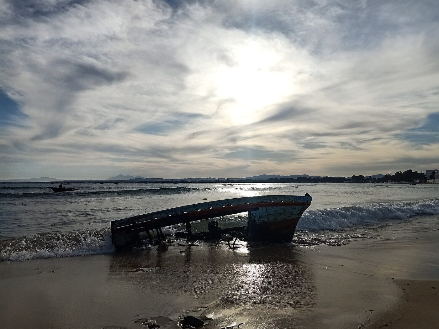
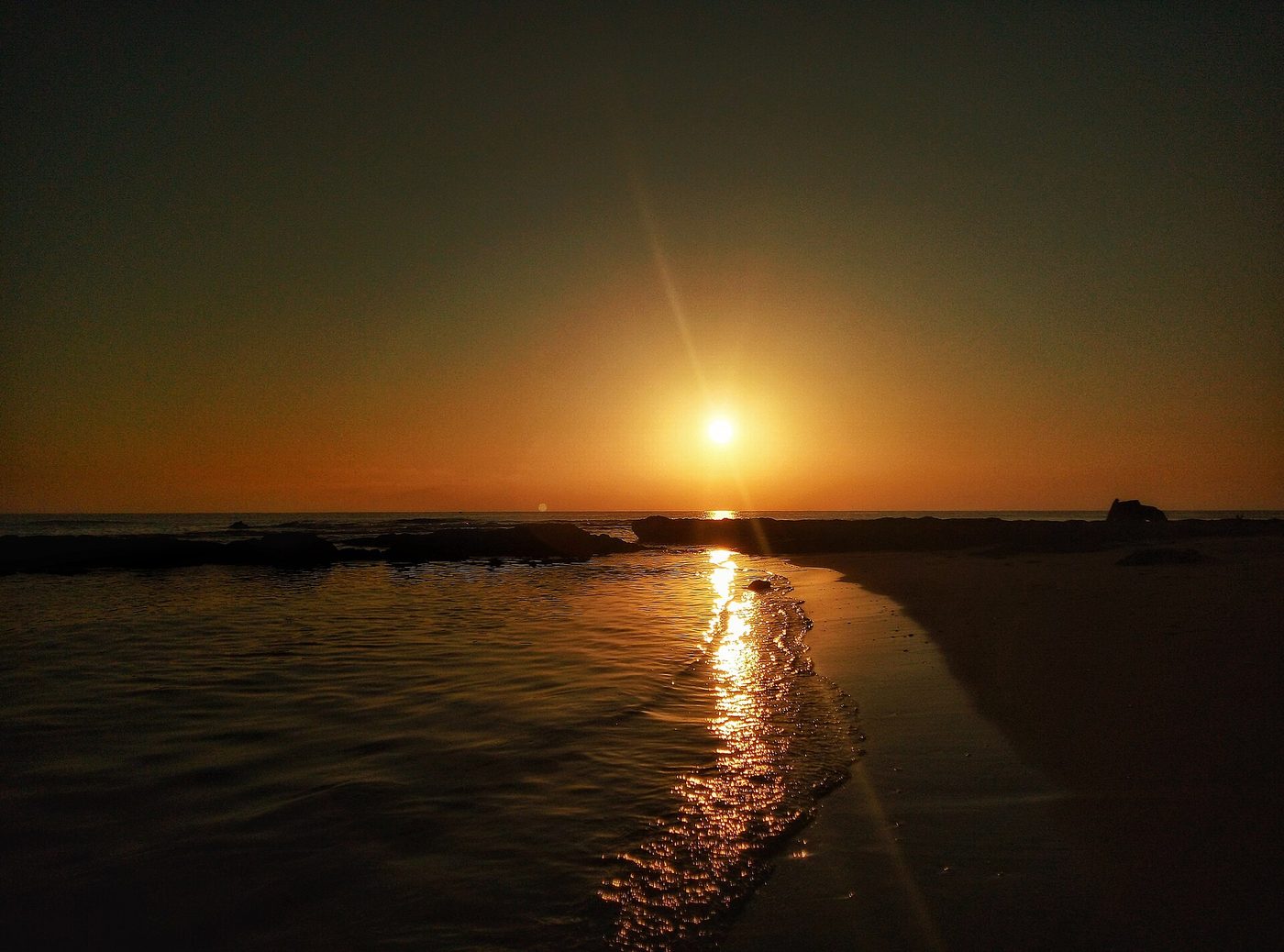
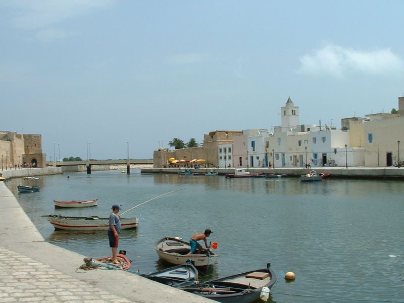
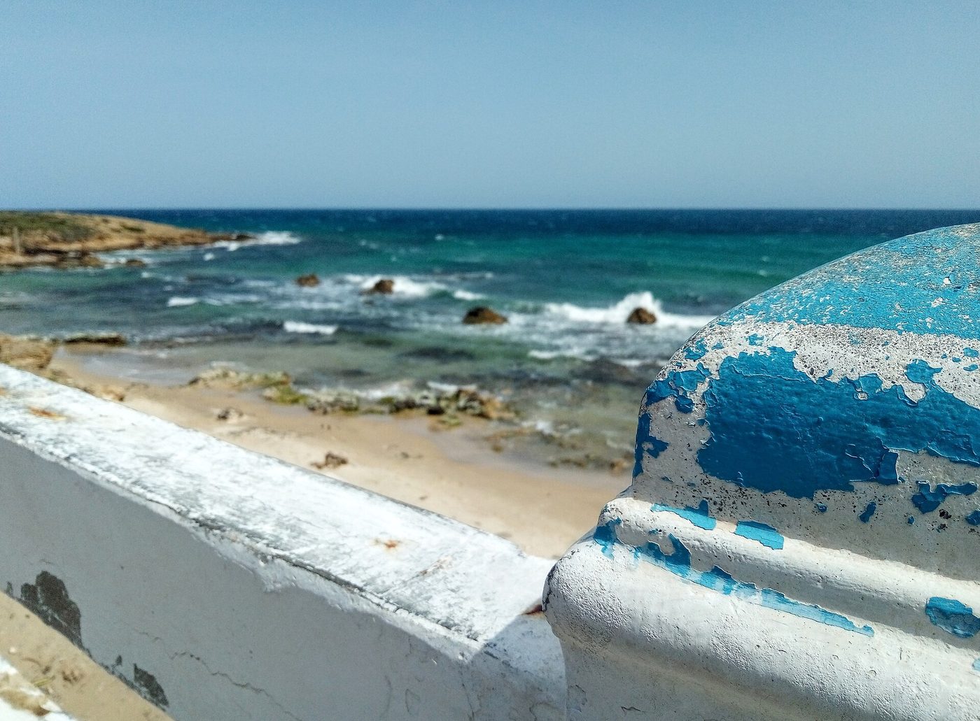
All images via Wikimedia Commons, used with thanks: The bay at Rafraf with the Pilau rock offshore © Citizen59 (CC BY-SA 3.0); Forested headland dropping to the sea near Cap Serrat on © DrFO.Jr.Tn (CC BY 3.0); The sand spit and lagoon at Sidi Ali El Mekki © Citizen59 (CC BY-SA 3.0); A rocky stretch of the Bizerte corniche on Tunisia’s northern © Ijgjnx (CC BY-SA 4.0).